

Interactive Coastal Investigations WebGIS
Intertek develops an innovative webGIS solution
01 May 2018
Intertek Energy & Water Consultancy Services (EWCS) recently completed the modelling and compliance requirements for the largest coastal investigation for Dŵr Cymru Welsh Water (DCWW). The work investigated a range of water quality issues at bathing and shellfish waters to help target investment to support environmental outcomes. The work included developing new coastal models for the whole coastline, dedicated supporting surveys, network modelling and compliance studies for 49 sensitive receivers. The Intertek EWCS team was sub-contracted to provide specialist support to DCWW's Capital Alliance Delivery partners. This included survey specification and management, modelling and compliance assessment expertise, and Intertek EWCS worked as the technical lead partner for all compliance assessments.
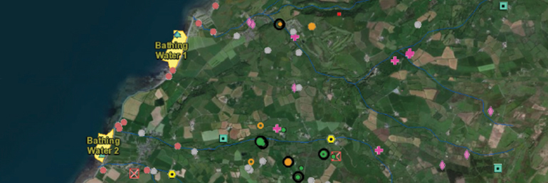
As part of the reporting deliverables for the projects, Intertek EWCS created various PDF mapping outputs to visualise the compliance results data. Utilising an Intertek-developed Geographic Information System (GIS) tool, the team was able to rapidly develop these outputs in a consistent format that ensured continuity in data processing methods and enabled effective management of GIS data. Compliance results were visualised as a series of pie charts, depicting compliance with the relevant criteria (e.g. 90%ile and 95%ile concentrations of Escherichia coli (EC) and Intestinal enterococci (IE) for comparison with the Bathing Water Directive assessment criteria) and resulting classifications, with pie chart segments representing the proportional contribution from key sources to the quality of the receiving waters. Alongside the pie charts, the maps also displayed numerous supporting datasets including locations of wastewater treatment works, outfalls, combined sewer overflows, river flow gauges and sampling sites across each of the project study areas. In addition to these PDF outputs (that formed part of each of the main compliance reports), various other deliverables were also drafted for the investigations, namely sewer network reports and plans, and calibration/validation reports.
To support the assessment outputs created for the programme, Intertek EWCS's GIS team developed an innovative webGIS solution containing a complete and comprehensive database of all modelling data results and supporting GIS layers. As well as all assets, assessment locations and other background datasets, the system displays compliance results as interactive and responsive pie charts within a web page, acting as a central portal of information and results for all study areas. Users can interrogate data layers and gain access to attribute information and directly access supporting documents such as the compliance reports, calibration/validation reports and sewer reports and plans.
The application has been very well received by DCWW, who intend to use the tool to present and discuss the outcomes of the projects with the environmental regulator, Natural Resources Wales, as well as to communicate the results of the project to internal and external stakeholders. Below is a demo version of the application developed for DCWW for one location only. All data has been anonymised and is for illustrative purposes only. For further information on Intertek's webGIS capabilities, please send an email or visit our website.
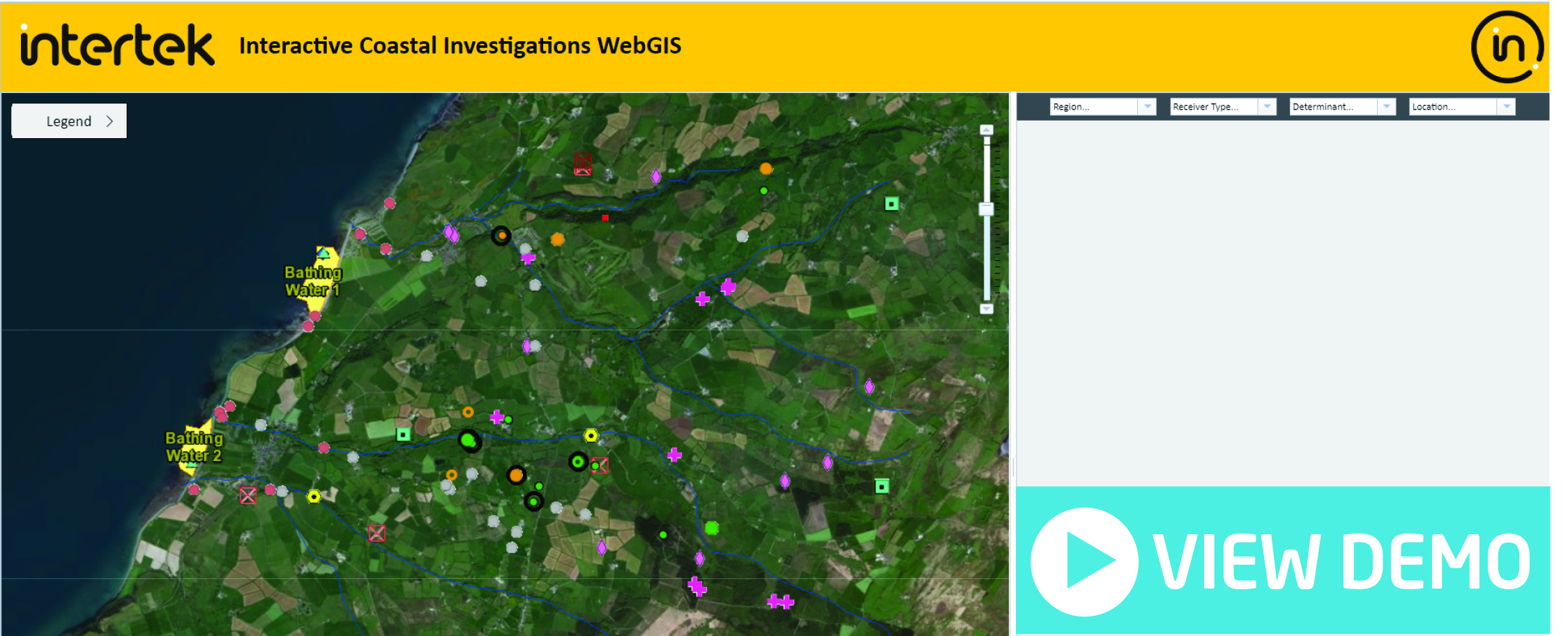
After you click the "View Demo" button, follow these steps below to view the compliance result pie charts:
- Select the Region, Receiver Type, Determinant and Location.
- Hover over the pie chart segments to view the location of the associated asset.
- Click on the coloured shapes within the green terrain to reveal the informative pop-ups. (These pop-ups have been configured for the Wastewater Treatment Works (WWTW), Scoped CSO, Modelling Discharge and Modelled Source layers.)
Richard specialises in the development of GIS applications within the marine environment sector. He has specialist skills in a number of different programming languages including HTML, JavaScript, Python, VB.NET and VBA, using these to create innovative data visualisation products that streamline marine GIS and data workflows.
Tags: 2018 | Environmental | Marine | Richard Marlow

Richard Marlow,
Intertek Energy & Water,
GIS & Applications Developer